What is Geotechnics?
Definition
Geotechnics is a discipline that studies the mechanical behavior of soils and rocks for construction and structural stability.
Objectives
To analyze the bearing capacity, stability, and mechanical properties of soils for construction, civil engineering, mining and railway activities.
Methods used
Boreholes, in-situ tests (penetrometers, pressure meters, plate load tests), laboratory tests on soil and rock samples.
Applications
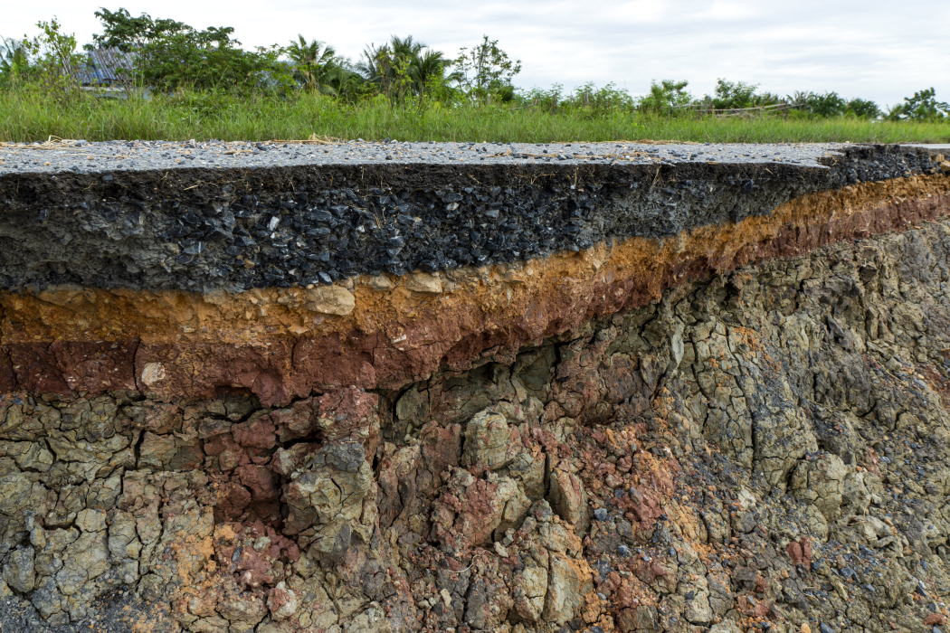
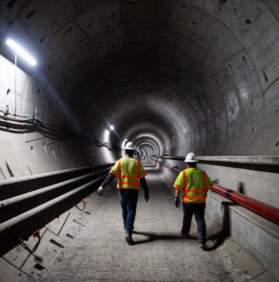
Building foundations, design of dams, tunnels, roads, landslide prevention, railway maintenance, mining.
What is Geophysics?

Definition
Geophysics is a science that studies the structure and properties of the subsurface using physical methods (seismic waves, electrical resistivity, gravimetry, etc.).
Objectives
To explore and map the underground structures for various applications (oil, mining, hydrogeology, natural hazards).
Methods used
Seismic, electrical, electromagnetic, gravimetry, ground penetrating radar (GPR), etc.
Applications
Oil and mineral exploration, natural hazard studies (earthquakes, landslides), groundwater detection, archaeology.
How does Geophysics contribute to Geotechnics?
Geophysics is a great asset to geotechnics because it provides a non-intrusive and complementary approach to traditional borehole and in-situ testing methods. Here are some of the ways it can contribute effectively:
Pre-drilling subsurface mapping
- Helps identify subsurface heterogeneities (cavities, faults, water tables, soil layers).
- Optimizes borehole placement and reduces study costs.
Evaluation of soil and rock mechanical properties
- Seismic refraction helps estimate P- and S-wave velocities, which are related to soil compaction and stiffness.
- Electrical geophysics identifies contrasts between different soil layers.
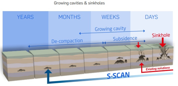
Detection of weak zones and geologic hazards
- Identifies areas of fill, underground cavities, or unstable soils that may pose a risk to the foundation.
- Monitors the evolution of areas at risk (landslides, subsidence).
Quality control of soils after compaction or reinforcement work
- Verifies the effectiveness of grouting or dynamic compaction using seismic tomography.
Conclusion
Geophysics is a valuable tool for geotechnics, providing a rapid and non-destructive understanding of the subsurface. By combining the two disciplines, a more comprehensive analysis is obtained, optimizing safety and cost-effectiveness in civil engineering, railway and mining projects.
Sercel's expertise in seismic acquisition innovates with an imaging solution for ambient noise tomography, which gives the possibility to have a high resolution image of the subsurface to take the right decision.
Reach out today to learn more about our subsurface imaging solutions.